
Share this:

Yes, November is the month when I get to be self-indulgent and show off my #30DayMapChallenge maps so here come some more. The daily theme is listed after each day.
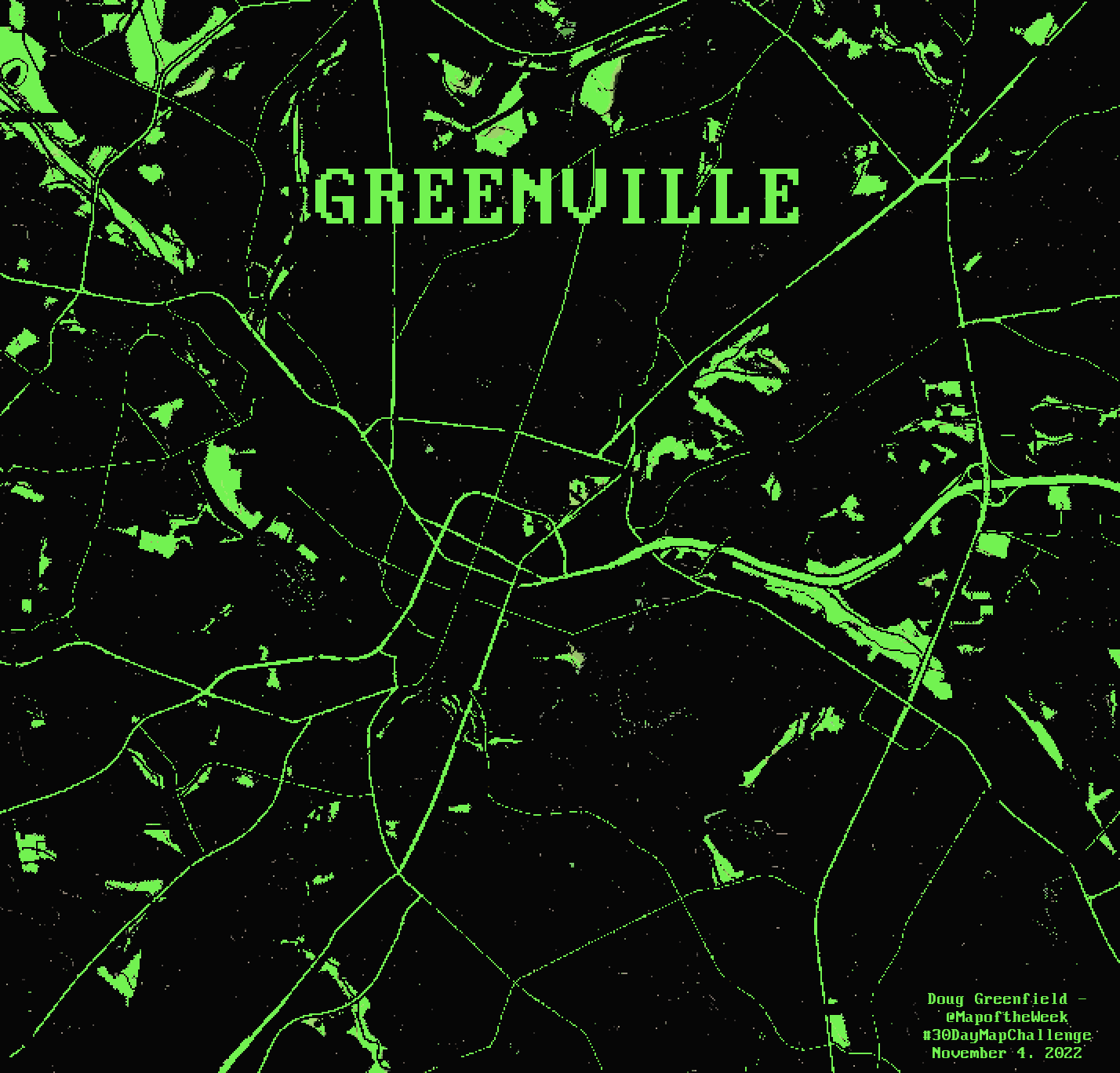
Day 4 – Green

For green day I made a map of Greenville, the one in South Carolina, giving it the 1980’s computer screen look. I brought down the resolution a bit for the pixellated feel and found a font from that era.
Day 5 – Ukraine

Locations of sunflower fields in Ukraine were taken from this Wikimedia Commons page. Most of the photos have location coordinates listed deep in their metadata. I used a caricatured country outline from Project Linework, except for Russia (not included in their data) which I drew my own coastline for.
Day 6 – Network

This was not my most successful idea but I’d been working on overlaying transit maps onto a cartogram (so the large urban areas have space). To be as objective as possible and keep this project from blowing up, I only used the “heavy rail” systems as listed by Wikipedia. The page lists 15 systems covering 12 metropolitan areas. I did not include San Juan, Puerto Rico because it’s not part of this cartogram. If I started including cities with “light rail” systems, I might need to add various suburban commuter systems and it would be a large slippery slope that I might never get up from. The cartogram was modified to remove some of the large empty area between Chicago and Los Angeles.
Day 7 – Raster

I may have “mailed this one in” a bit but I wanted to play with some color manipulations in GIMP. The original image came from this page from University of Michigan. I like the perspective.
Day 8 – OpenStreetMap

OpenStreetMap is the Wikipedia of geodata. I grabbed some ice cream places and mapped the Ísbíltúr – Iceland’s ice cream road trip tradition. All data including the coastlines and parks are from OpenStreetMap.
Day 9 – Space

I’ve never been to the Maine Solar System in Aroostook County but I hope to see it some day. Here is a map showing where the planet models are located. More on the system here. The picture of Saturn in situ was taken from Google, user Amy Doucette.


More Stories
Will County, Illinois 1864 Map – May 20, 2023 at 04:14AM
This kid on Google Map trying to get by – April 27, 2023 at 05:05PM
World of Hyatt: Complete list of all-inclusive properties in Europe (with map) – April 27, 2023 at 04:57PM